Satellite images show new life in the desert after South Australian floods

March 14, 2022

While recent heavy rainfalls in South Australia wreaked havoc for roads and farmlands with flooding, there might be a silver lining for local wildlife, as the landscape of the desertic outback has begun to transform.
 
New satellite images from Soar have helped us identify key areas where these changes are occurring.
Lake Cadibarrawirracanna, east of Coober Pedy
After those rainfalls, Lake Cadibarrawirracanna (also known as “Lake Cadi”) was refilled. Lake Cadi is a salt lake, east of Coober Pedy: a town that was left isolated during the floods while Stuart Highway was impassable. During the heavy rainfall, the crucial travel route of Stuart Highway was blocked between Glendambo and Coober Pedy, causing freight issues for more than just locals. Sentinel-2 satellite images below show the area before and after the floods:

While the floods lead to food supply shortages for the Northern Territory and rural towns in South Australia, they seem to have benefited local flora. The animated sequence of Sentinel-2 satellite images below of before-and-after the floods, were taken using False Color “Near InfraRed (NIR)” band composition preset, which displays vegetation density as reddish colors, bare ground as tan-gray, and water as vivid to dark blue. The red sections in these images highlight the boom of vegetation growth and the blue shows the refilling of the lake in the weeks following the rains.
According to locals, these rains have also revived the ecological chain of flora and fauna. You can browse the changes using the Soar satellite search here.

Lake Gilles, east of Kimba, Eyre Peninsula

It was reported that Kimba, in the Eyre Peninsula, had 160mm of rain in 24 hours on 22 January. Lake Gilles, an ephemeral lake system east of Kimba, which usually has many dry areas, received a huge amount of water. The main lake filled, along with its many small lakes in the limits of farmlands and the desert, which can be seen in before-and-after satellite imagery from Soar below.

The silver lining

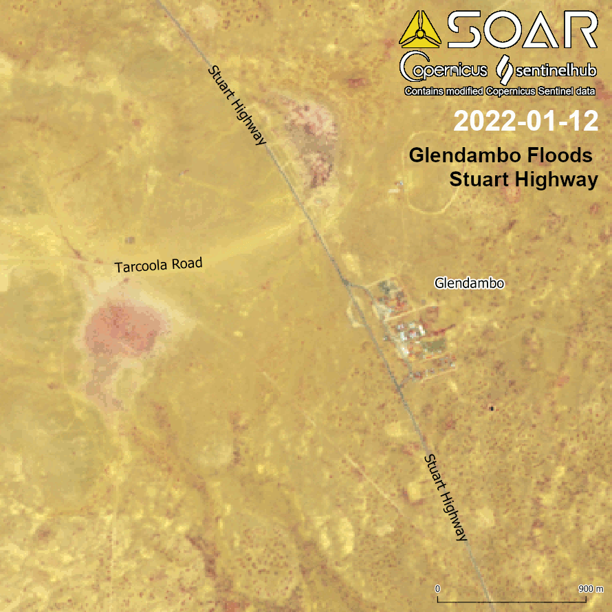
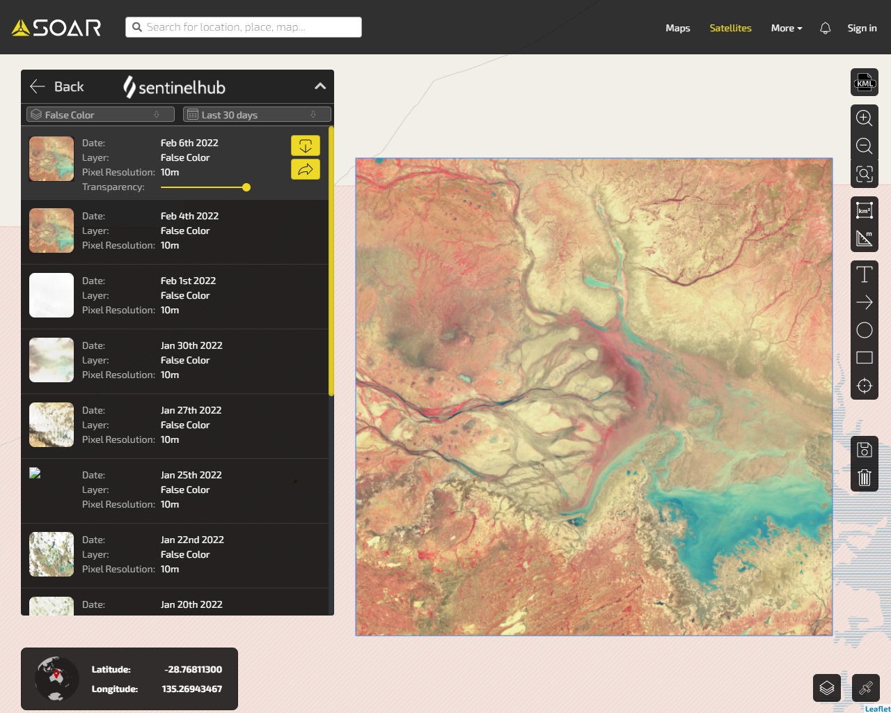
The impacts of the floods have stretched right across Australia, creating supply chain issues, food shortages and other issues for a lot of people. However, these maps show they have also brought the previously dormant desert outback to life, with an explosion of new plants. There are reports on the ground that frog, bat, bird, and insect life have increased in the areas.

You can continue monitoring the area and the changes in the landscape using Soar satellite imagery.