August 15, 2021

Caleb Fagunloye is a philanthropist and professional with a passion for facilitating positive change through technology. His team at Nigeria Flying Labs South West Hub was among the first innovations at the AfricaVsVirus Challenge hosted by Africa Development Bank during the COVID crisis and among the top 30 finalists of the Drone Business Competition hosted by Global Drone Air Academy. Caleb uses his expertise in data science, GIS analysis, remote sensing, satellite imagery, aerial photography, drone technology, and ESRI software to advance Nigeria’s humanitarian efforts.
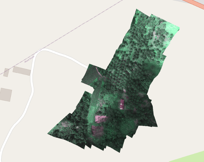
Orthomosaic drone image of Palm tree plantation field in the Federal University of Technology Akure | The area of the plantation cover about 62.89 hectares and 4095.99 in perimeter.| Processed on: Pix4dFields |
Courtesy of Nigeria-Flyinglabs SW Hub
Drones Used
- Multispectral drones like Parrot Bluegrass
- DJI Phantom
- DJI 4 Professional
- Lidar drones (3D models for superior planning and accuracy)
Caleb was drawn to the humanitarian applications of GIS at an early age
As is the case with many professionals in the industries related to satellite imagery, Caleb has loved satellites and space since childhood. “I was intrigued by how satellite and hyperspectral sensors were used for oil and gas exploration.” He also remembers being fascinated by the use of GIS and remote sensing in emergency response and disaster mapping. Volunteering at a young age for UNICEF and the Humanitarian OpenStreetMap Team, Caleb recognised the impact that GIS and remote sensing could have on countless lives. “My passion grew more when I discovered John Snow’s work… [making] use of GIS in early 1854 for Cholera detection.”
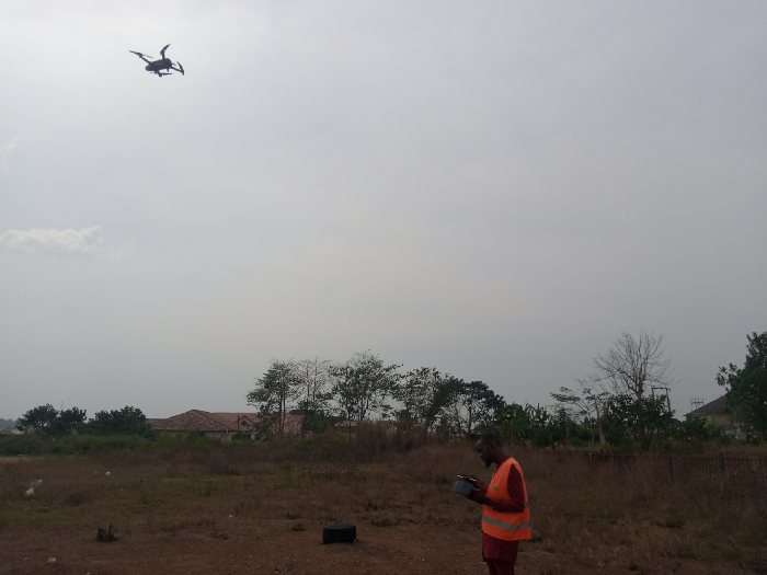
Caleb Fagunloye prepares for his next drone mapping mission
Fascinated by Maps and Satellite Imagery
“Maps are beautiful. They appeal to us visually and inspire imagination, but most importantly, maps arrange information spatially and help us better understand the world we live in and our position on Earth.” From a humanitarian perspective like Caleb’s, maps contain invaluable, life-saving information in a simplified format. Satellite imagery informs cartographers, pilots, rescue missions, and meteorologists. They give a “clear, concise, and accurate representation” of events as they unfold and enable us to study the phenomena of the Earth’s surface.
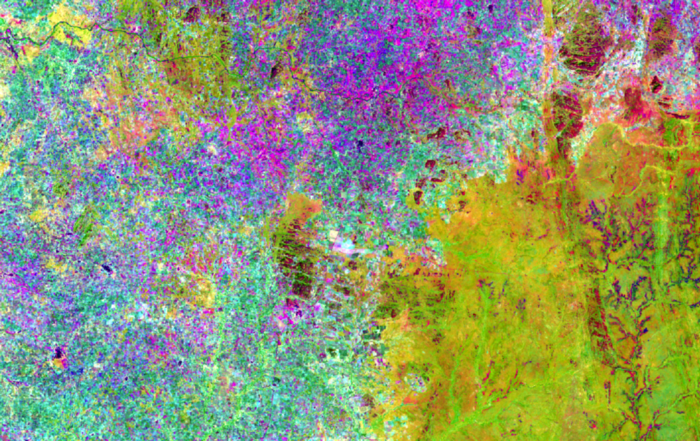
Mineralogical and Geochemical Characterization of Gold Bearing Quartz Veins in Parts of Maru and Gusua Schist Belt Area, Zamfara.
View on Soar
Humanitarian Projects in Nigeria
Caleb created a dashboard for an NGO that managed internally displaced persons (IDPs) in Nigeria. The map showed various locations of IDPs, their needs, and their population across their locations. Using LIDAR remote sensing, Caleb assisted in mitigating farm loss in local African communities. To aid in agricultural and deforestation efforts, Caleb helped map the road system and 16 forest reserves.
During the pandemic of 2020, he created a dashboard that would update people on the virus’s status in Nigeria. For Ondo State, Caleb worked to create a dashboard that displayed the location of natural resources, health facilities, forests, farm camps, pharmacies, etc. Other projects include prediction of farm output, tree counting, and a dashboard for monitoring the community reach of the Oando Foundation. “My work was recognised by ESRI and was showcased in the ESRI User Conference.”
Notable Projects:
- Lithological and structural mapping of Zamfara and part of Kaduna State
- Mineralogical and geochemical characterization of gold-bearing quartz veins in parts of Maru and Gusua Schist Belt area, Zamfara
- Ocean classification
- Nigeria COVID-19 dashboard and web application
- Rural access and agricultural marketing project
- Field mapping of Ipetu-Ijesha, Osun State, Nigeria
Global Data Access from Soar
“Soar is a great platform, and I believe geographers, cartographers, and GIS specialists should be proud of the great stride Soar is making.” Caleb considers the limitations imposed by a lack of current, accessible data compared to up-to-date, high-res images of every part of the world. “I believe this is a great move. Soar has ameliorated the burden on researchers in [the] GIS field. It has allowed GIS analysts to showcase their works and [be] recognised. It has also helped in developing and providing a global archive of the dataset from every part of the world which could be viewed or downloaded for any type of project. I believe in the vision [of] Soar and believe it will even do better.”