November 4, 2022

This report contains a summary of qualitative research conducted by Soar using publicly available data from the NASA night time satellite sensors over Ukraine. The collection of imagery processed by Soar compares imagery from before the Russian invasion through to the month of October, 2022.
Image dates are as follows:
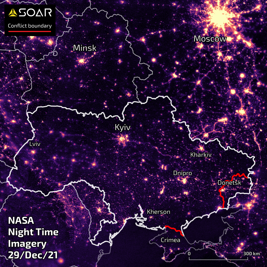
- BEFORE the invasion: 29 December 2021
- AFTER the invasion: 23 March, 28 September, 17 and 28 October 2022
Image metadata is as follows:
- NASA Black Marble Nighttime At Sensor Radiance (Night Band)
- Document description code: VNP46A
- Sensor source: VIIRS/NPP
- Pixel resolution: 500m
Special notes:
- Slight ‘blurring’ of pixels is due to cloud cover
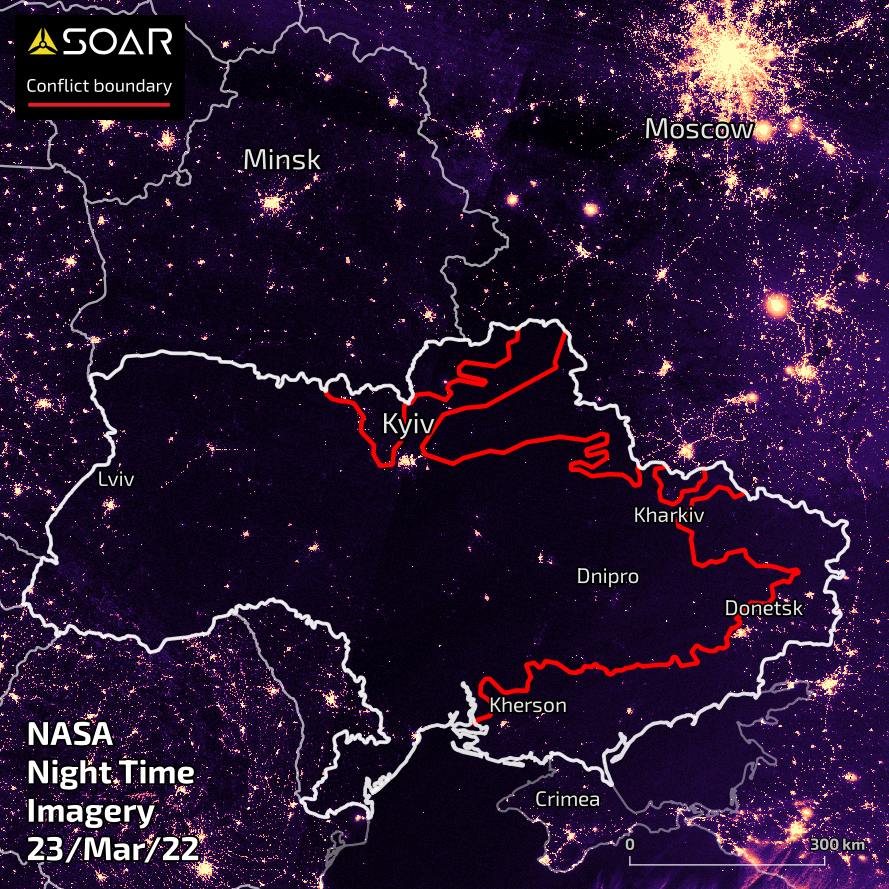
IMAGE 2 of 5: 23 MARCH 2022
Almost one month after the start of the conflict, there is significant darkening of night time lights across Ukraine. No visible difference across the borders of Russia and Belarus as a comparison. Regional areas of Ukraine have seen significant decrease of night time lights in particular the eastern parts of Ukraine, especially in the area around Kharkiv.
(NB: Purple hues located over Belarus and Russia are due to sporadic cloud cover diffusing light).
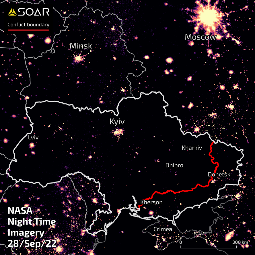
IMAGE 3 of 5: 28 SEPTEMBER 2022
By late September, 2022, the Ukrainian armed forces have successfully repelled the Russian invasion in northern and eastern areas. Significant increase of night time lights around Kyiv is visible. Although most of the newly liberated eastern areas are still dark, central regional areas of Ukraine are seeing a slight increase in night time lights.
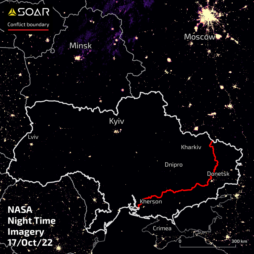
IMAGE 4 of 5: 17 OCTOBER 2022
This image was taken a few days before the mandatory nation-wide rolling blackout that was imposed from 20th of October across Ukraine. It shows a scene very similar to the one taken in March 23rd, one month after the conflict started. Although the Russian forces have been pushed back to almost their initial invasion gains in the southeast, there appears to be a lack of significant increase of night time lights across broader Ukraine: likely due to sustained strikes by Russian forces targeting critical electrical and other energy infrastructure establishments.
(NB: Purple hues located over Belarus and Russia are due to sporadic cloud cover diffusing light).
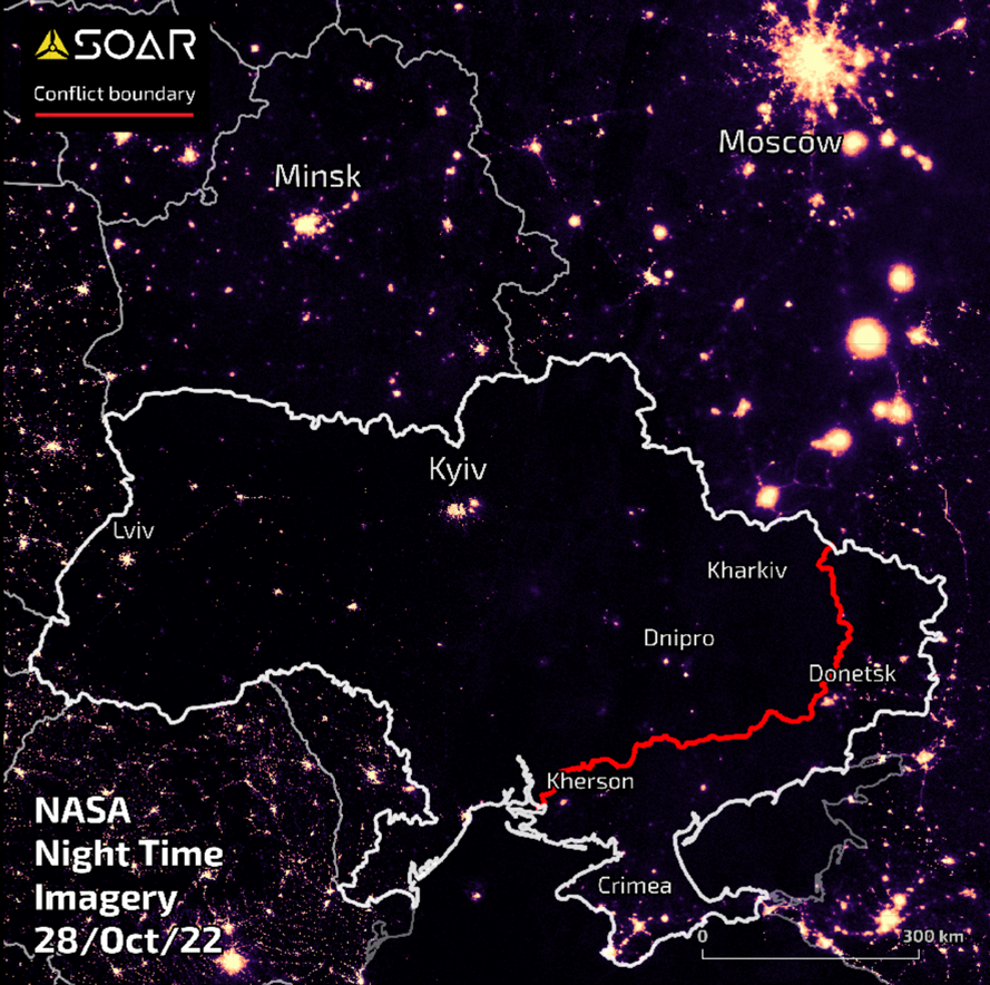
IMAGE 5 of 5: 28 OCTOBER 2022
Interestingly, 8 days after the nation-wide mandatory rolling blackouts, there appears to be a slight increase in night time lights, especially in the area around Dnipro in eastern Ukraine. This could be the result of increased energy supply at the precise time of the satellite image being taken or the combination of Ukrainian infrastructure being repaired.
view on Soar
To view more maps around Ukraine, hop on over to
Soar and zoom into
Ukraine. We have many amazing mappers who upload new content every day.

This blog was written by:
Sergio Volkmer
Sérgio is a mapping and remote sensing enthusiast, producing content for Soar. He studied geology and holds a Master of Philosophy, and is now an architect and contributor to OpenStreetMap and OpenData communities. He believes that information and knowledge are first steps towards personal fulfilment that lead to a better world.
View author's Soar profile