How Soar gives context to your maps

Make your maps special using the transparency slider and pinning tools

October 20, 2022

One of my favourite things about maps and imagery is seeing how things changed over time. Now that the world has access to more imagery than ever, we can easily track changes with many different types of imagery, faster revisit times, and more detail. Using Soar’s evergrowing digital atlas we can explore these changes more effortlessly than ever before.

For this blog, I’m going to use Cape Canaveral as my example location, not only because I’m a spaceflight nerd, but because there’s lots of imagery out there that’s perfect for showing off this capability.

Let’s start by comparing an aerial image taken in 1950, to the ‘Google Satellite’ base map from early 2022. Using the transparency slider we can see how much the area has changed in the last 72 years. From farmland, to launch complexes lining the coast, a 5km long runway, Port Canaveral near the bottom of the image, and so many residential areas.
However, this comparison is quite a significant jump in time. Try it yourself, I’ve embedded the map below for you to interact with and compare using the transparency slider.
But what if we want to do something with two images that were taken closer together?

Here I used Soar’s ‘pin’ feature to add the aerial image from 1950 to my ‘pinned layers’ menu. Next, I’m going to select a declassified spy satellite image from 1967 so we have a 17-year difference in images. Using the transparency slider we are able to see that the changes are still significant between the images.
Next, I want to have a look at how the area has changed since the Google imagery was taken in early 2022. By using the Sentinel-2 imagery search feature I selected an image from September 12, and now we can use the transparency slider to view changes. In the gif below I also used the annotation tools to highlight a few locations where we can see changes in the imagery. These particular changes are from the construction of new factories and launch facilities.
Using the transparency slider is one of the many ways Soar gives further context to our maps, so give it a try! You’ll be surprised to see how quickly our Earth changes.
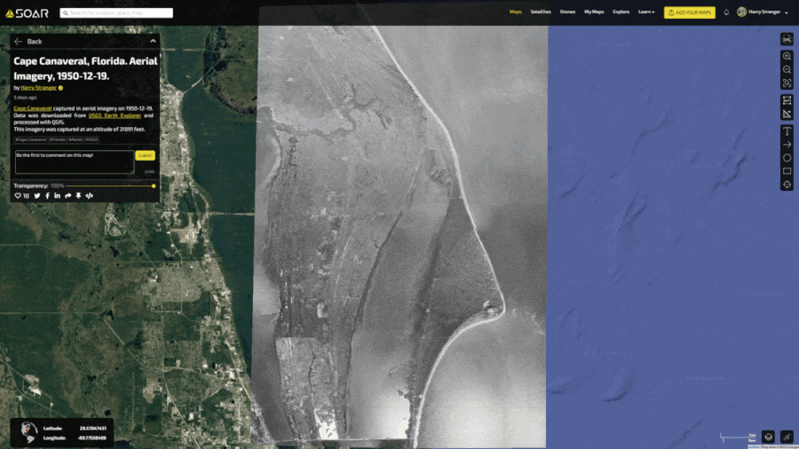
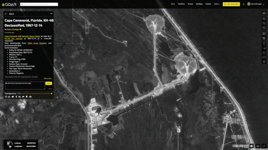
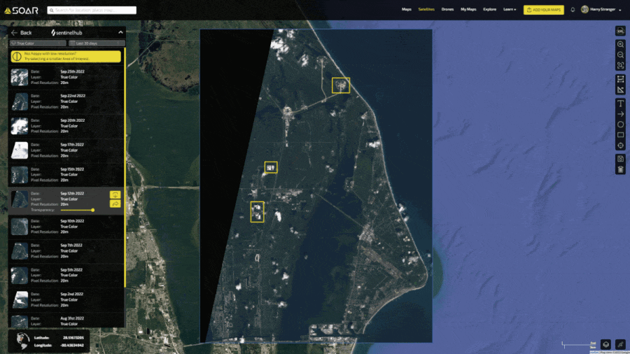
This blog was written by:

Harry Stranger

Harry is a content specialist, mostly focusing on satellite imagery curation, processing, and analysing. In his free time outside of following the space industry he's passionate about landscape and astrophotography.

View author's Soar profile