February 24, 2023

Rocket crashes during launches can be devastating events, but they can also provide an opportunity for learning and improvement. Using satellite imagery, it's possible to investigate these incidents and gain a better understanding of what went wrong. In this article, we will explore three different examples of rocket crashes that have been investigated with the help of satellite imagery.
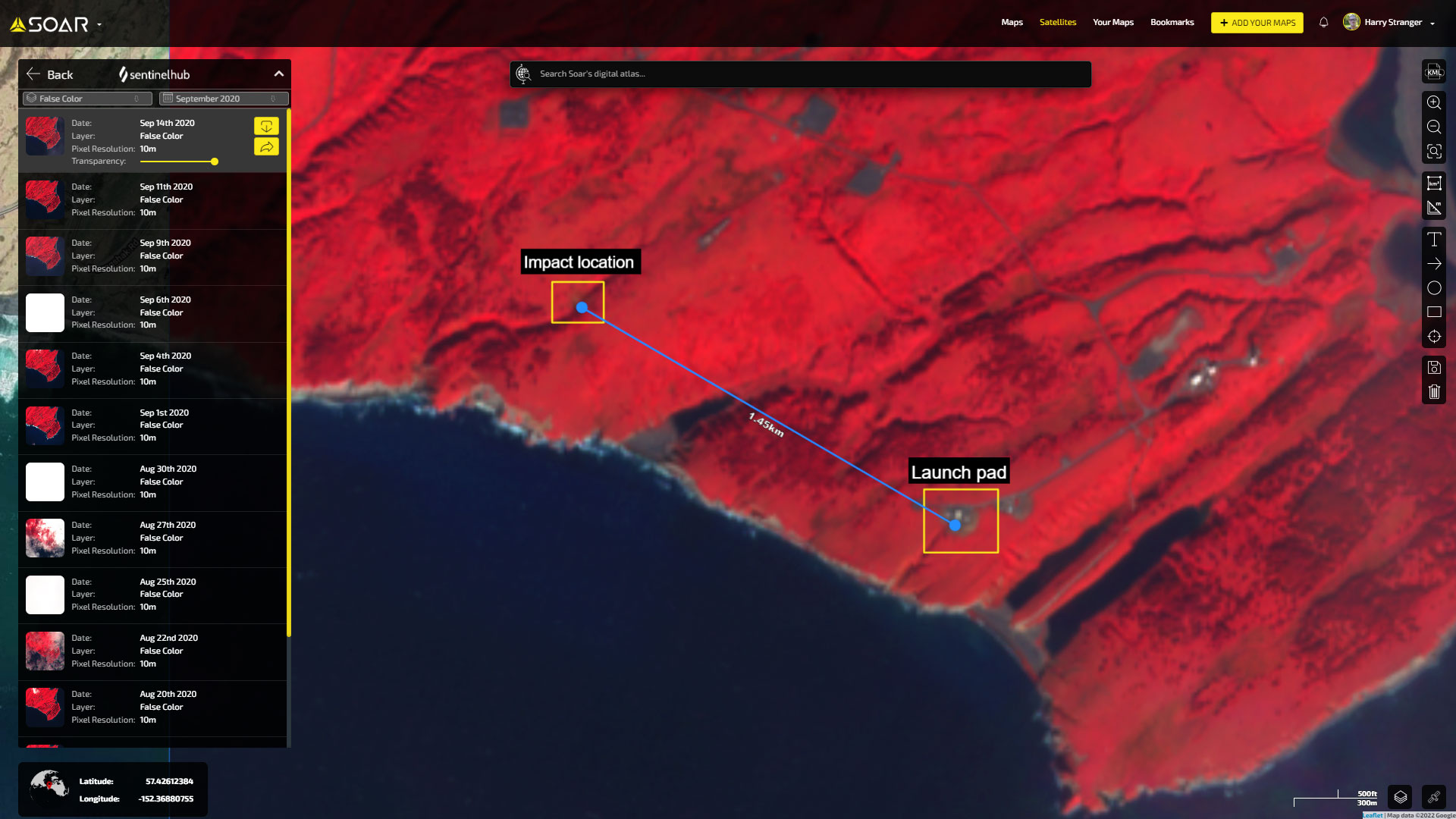
On September 12, 2020, Astra Rocket 3.1 launched from the Pacific Spaceport Complex on Kodiak Island, Alaska. Unfortunately, a software issue caused the rocket to experience an anomaly during the early period of the flight, leading to it tumbling back to the ground.
With the help of Sentinel-2 satellite imagery taken two days later, we were able to locate the spot where the rocket had impacted the ground, 1.4km northwest of the launch pad. You can still see the scar left behind on Google Maps imagery today.
Blue Origin New Shepard 23
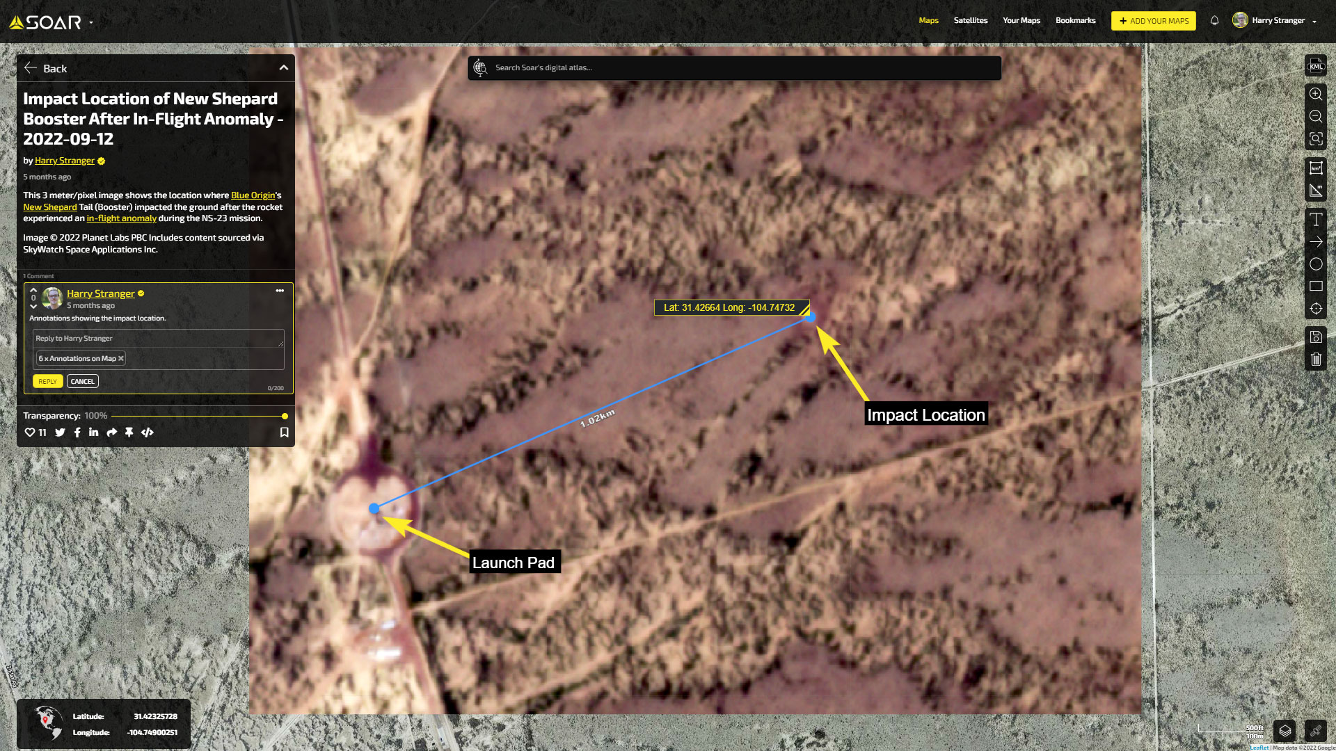
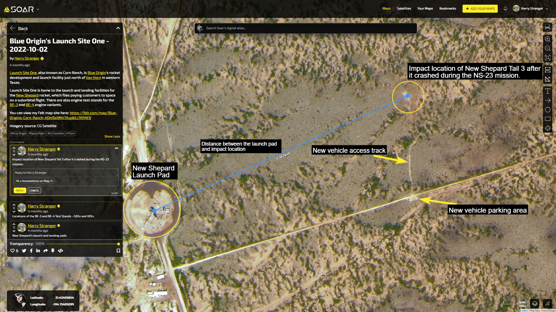
On September 12, 2022, Blue Origin launched the 23rd mission of their New Shepard program. During this uncrewed flight, the New Shepard booster experienced an anomaly around one minute and four seconds into flight. The capsule on top of the booster performed an inflight abort and safely escaped the failure of the booster before it landed safely under parachutes. Sadly, the booster wasn’t so lucky as it impacted the ground.
Due to satellite imagery taken approximately two hours after the launch, we were able to find the exact location where the New Shepard booster impacted the ground. This imagery also made it easier to follow up with higher resolution imagery, such as the 75cm/pixel satellite image purchased through
Soar , which allowed for more accurate measurements of the distance between the launch pad and the crash site.
ABL Space Systems
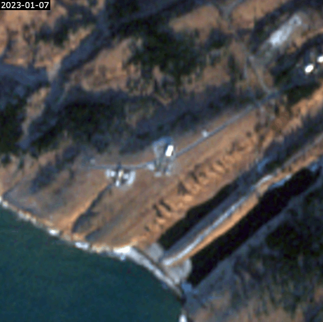
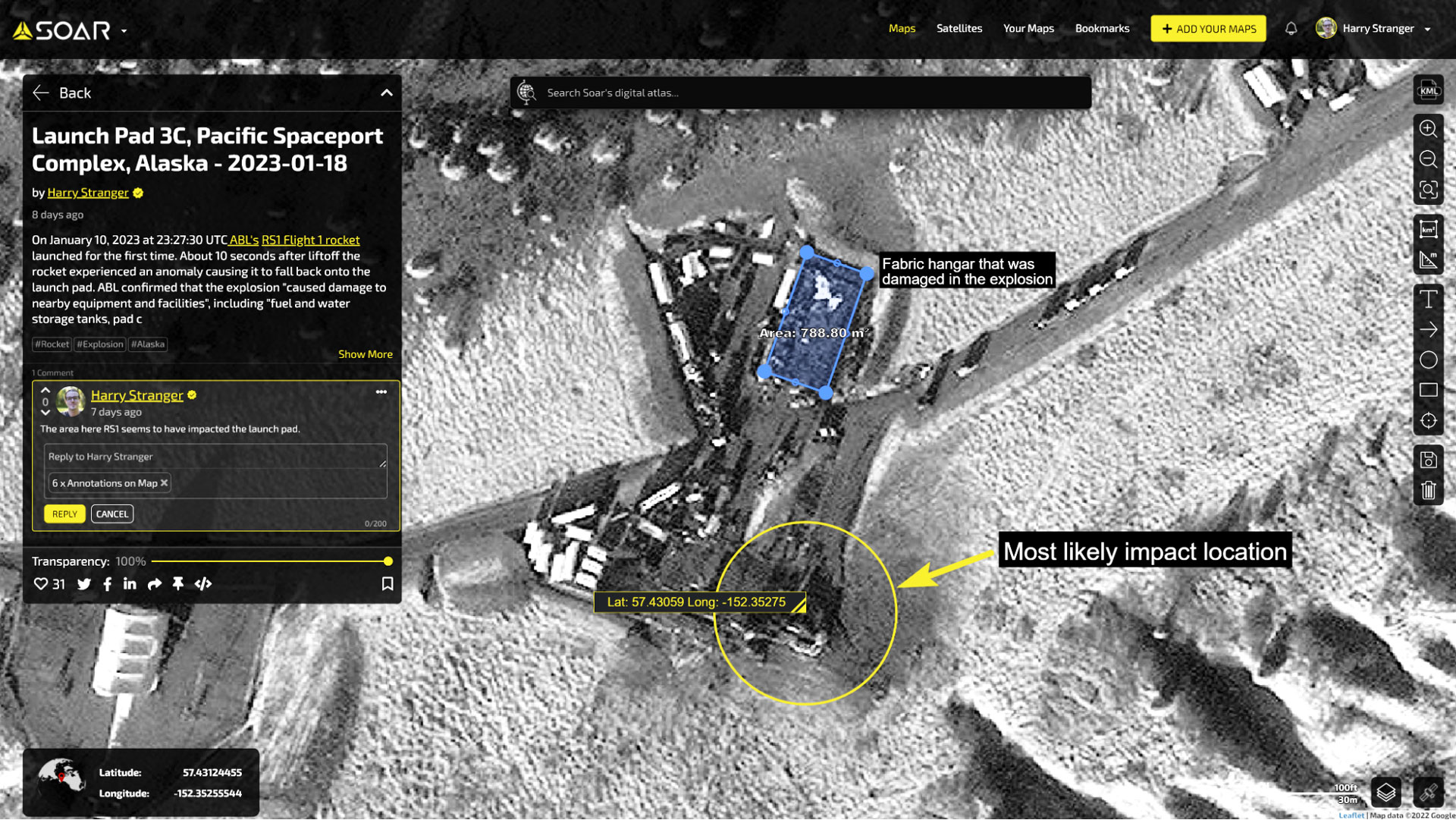
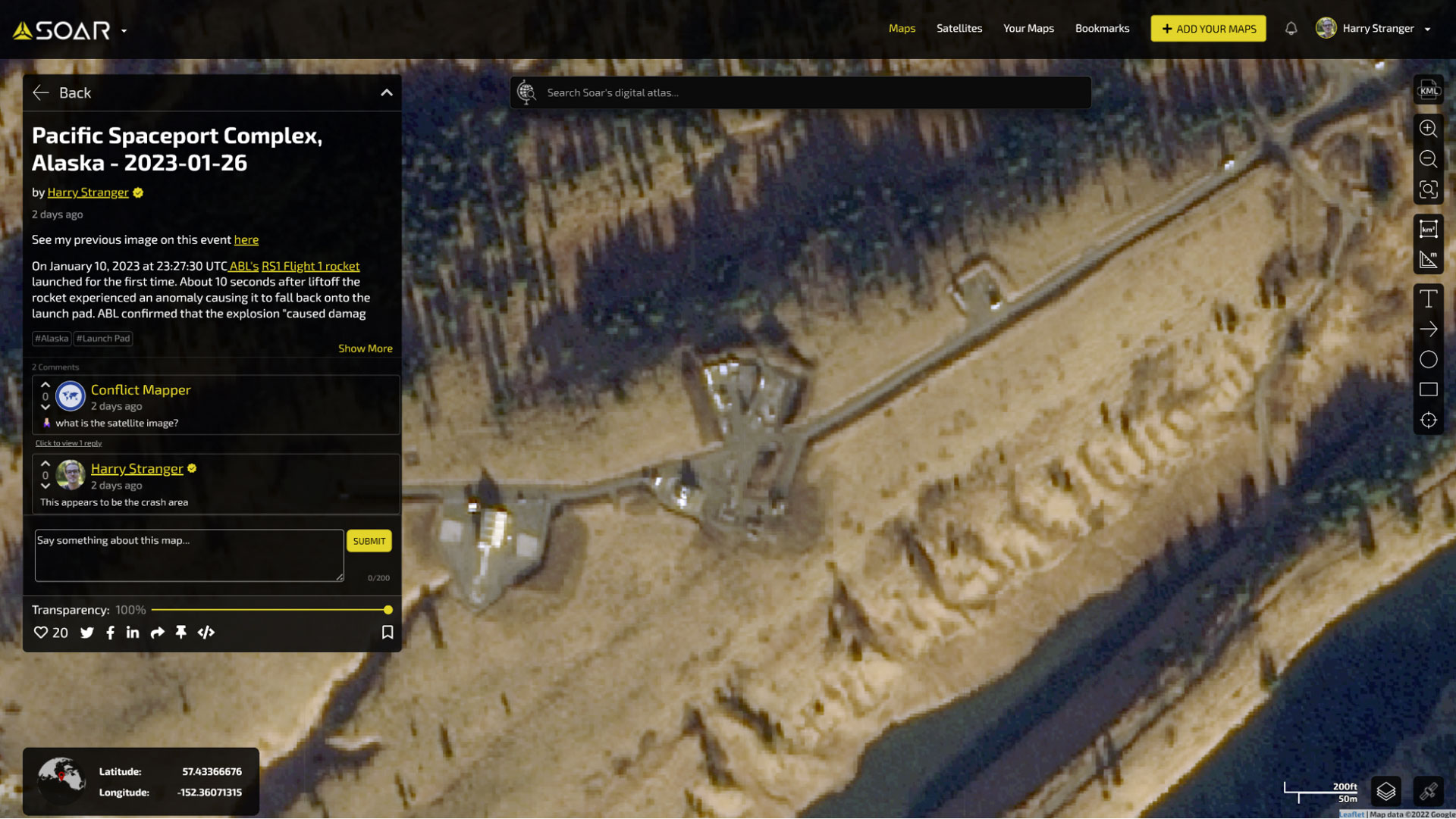
The most recent incident occurred on January 10, 2023, during the first-ever launch attempt of the RS1 rocket by ABL Space Systems. The rocket experienced a complete loss of power and crashed back down on the launch pad just over 10 seconds into the flight.
Sentinel-2 imagery taken on
January 12 gives us a low-resolution view of the area two days after the explosion, showing a darker area that may be scorching towards the southeast edge of the pad.
Six days later, on January 18,
WorldView-1 captured the scene in 50cm/pixel resolution, providing a much clearer view of the destroyed fabric hangar and scorched launch pad.
Eight days after that, a Jilin satellite captured the site in 80cm/pixel resolution, which allowed us to see that some equipment had been removed from the site.
Using satellite imagery in these incidents has helped to provide more insight and a better understanding of what went wrong. It's just one of the many uses for satellite imagery, and there are many ways to explore the different datasets out there. Hopefully, these examples have inspired you to consider the potential applications of satellite imagery beyond just mapping and navigation.
In conclusion, satellite imagery is a powerful tool for investigating rocket crashes and other events that occur around the world. From pinpointing the exact location of a rocket impact to providing valuable context for analysing the aftermath of an incident, satellite imagery offers a unique perspective that is often unavailable through other means.
As we have seen in the examples above, satellite imagery has helped to shed light on the circumstances surrounding rocket crashes and provided valuable insights for both industry experts and the general public. And with platforms like Soar providing access to high-quality satellite imagery, investigating these incidents has become easier than ever before. So whether you're a space enthusiast or a professional in the industry, the potential applications of satellite imagery are endless and should not be overlooked.

This blog was written by:
Harry Stranger
Harry is a content specialist, mostly focusing on satellite imagery curation, processing, and analysing. In his free time outside of following the space industry he's passionate about landscape and astrophotography.
View author's Soar profile