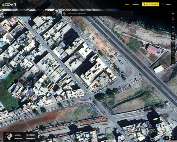
A map of Derna before the 2023 Libya floods, captured by high resolution satellite imagery.
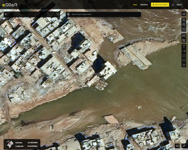
A map of Derna after the 2023 Libya floods, captured by high resolution satellite imagery.
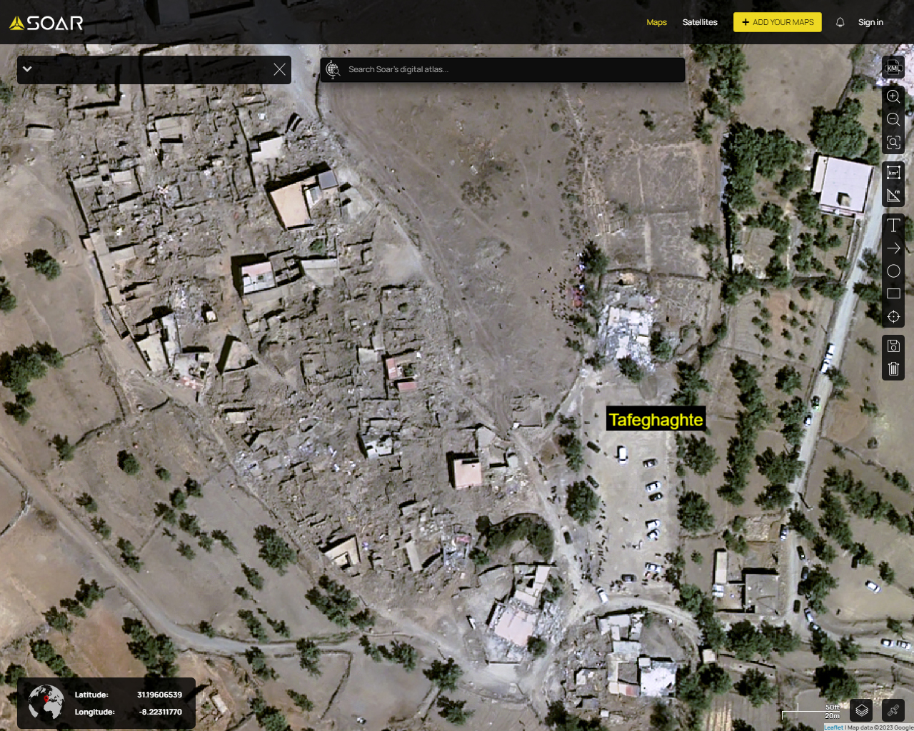
A map of Tafeghaghte after the 2023 earthquake captured by high resolution satellite imagery.
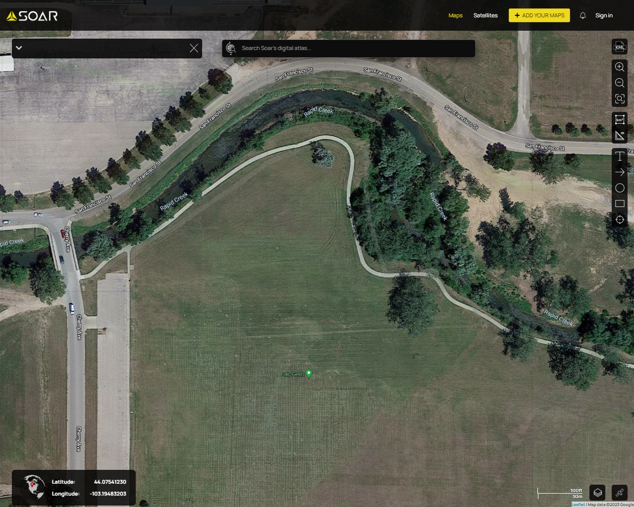
A map of Rapid City, South Dakota before the 1972 flash flood, captured by aerial photography.
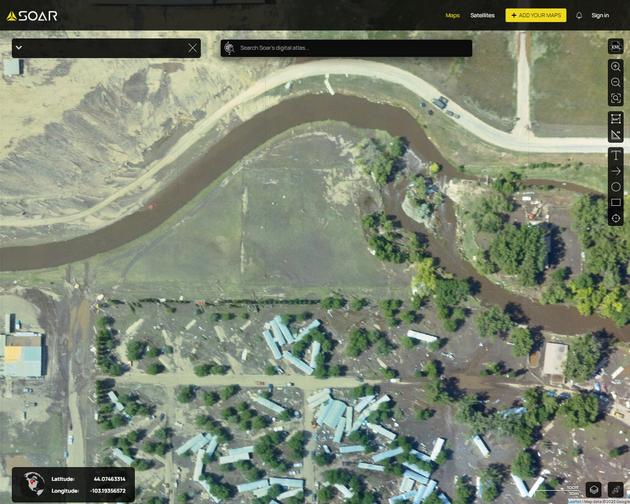
A map of Rapid City, South Dakota one day after the 1972 flash flood, captured by aerial photography.
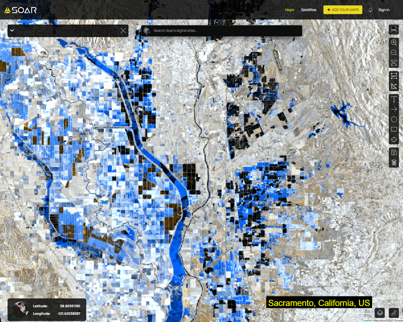
A map of Sacramento during the floods, captured by Sentinel-1 Radar (SAR) satellite on 13th Jan 2023.