Need help learning QGIS? Easy.
Converting coordinate formats? Pretty good.
Need a set of coordinates quickly put into a KML file? Not bad.
While the AI is continuously evolving, it's worth approaching these examples with a dose of caution. However, their potential for usefulness is undeniable. Let's delve deeper into their capabilities.
Here are the examples we will take a closer look at:
- Exploring the AI's assistance in learning QGIS and executing complex tasks effortlessly.
- Leveraging AI's accuracy in converting coordinate formats for seamless integration with geospatial applications.
- Harnessing the power of AI to convert coordinates into KML files, simplifying the process and saving time.

When it comes to learning QGIS or mastering new functions within the software, AI mapping assistants can be invaluable. Take, for example, the task of merging multiple GeoTiffs in QGIS and exporting the result. By simply posing the query, "How to merge multiple GeoTiffs in QGIS and export the result," AI platforms like
ChatGPT and
Google Bard can provide clear directions and eliminate the need for extensive web searches. These AI companions can prove particularly helpful for beginners or those seeking quick guidance. Once the desired map is created, it can easily be uploaded to Soar for effortless sharing with the global community.
The results are not bad! Both AI’s understood the task and gave good answers.
Google Bard was a little more vague than
ChatGPT, but you can always ask for more details or an elaboration and they will usually do a good job!
If you were to follow the steps above and merge multiple image tiles into one file you could then upload the map to Soar and share it with the world!
Changing coordinates to the desired format can often be a tedious task. AI mapping assistants offer a reliable solution to this challenge. For instance, let's say you have coordinates in degrees, minutes, and seconds and need them in decimal degrees for accurate mapping on Soar. By leveraging AI, such as
ChatGPT and
Google Bard, you can swiftly convert the coordinates. Although there may be slight variations in their responses, these AI systems demonstrate impressive accuracy.
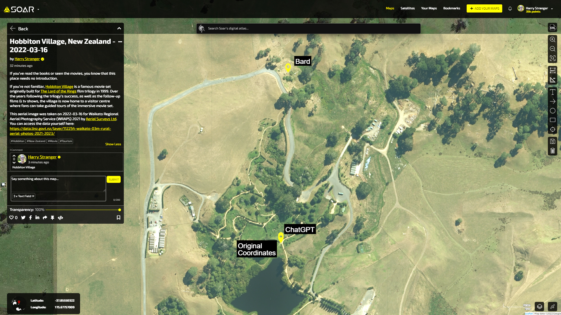
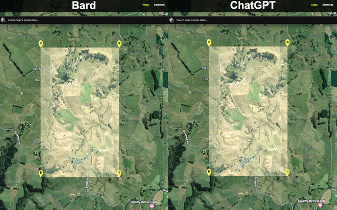
Comparing the converted coordinates on Soar reveals the alignment between
ChatGPT's results and the original coordinates, highlighting the potential of AI mapping assistants.
For example, let’s say you have some coordinates and want to search around that location on Soar. You can use AI to convert the format so you’ll have the right coordinates. Let’s use these coordinates in degrees, minutes, and seconds for example: 37°51'28.83"S, 175°40'52.50"E.
After asking
ChatGPT and
Google Bard to convert the coordinates to decimal-degree formatting we get slightly different answers.
ChatGPT gives a quick answer however,
Google Bard gives a more detailed response. After making a KML from each of these coordinates, as well as the original, we can load them into Soar and take a look at how close they are.
ChatGPT was very close to the original coordinates, however,
Google Bard is much further away.
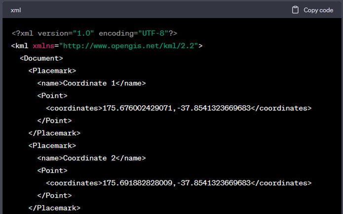
Transforming coordinates into KML code can be time-consuming without prior knowledge. However, AI mapping assistants can streamline this process significantly. Simply requesting the AI to convert coordinates into KML code yields prompt and accurate results. By copying the generated KML files and uploading them to Soar, you can visualize and compare the data points with ease.
In conclusion, AI mapping assistants offer valuable guidance and support for geospatial work. While they cannot replace human expertise entirely, they serve as reliable companions, helping users overcome challenges and providing solutions with around 80-90% accuracy. It is important to exercise caution and independently verify the information provided by AI platforms. Nonetheless, the integration of AI mapping assistants on Soar holds exciting prospects for the future. As we continue to witness remarkable contributions from the community, this month has seen an influx of stunning maps uploaded to Soar. Stay tuned for upcoming developments and be prepared to explore the world from new heights with AI assistance and our vibrant community of mapping enthusiasts.
Note: the above information was correct as of time of publishing.